GIS Interactive
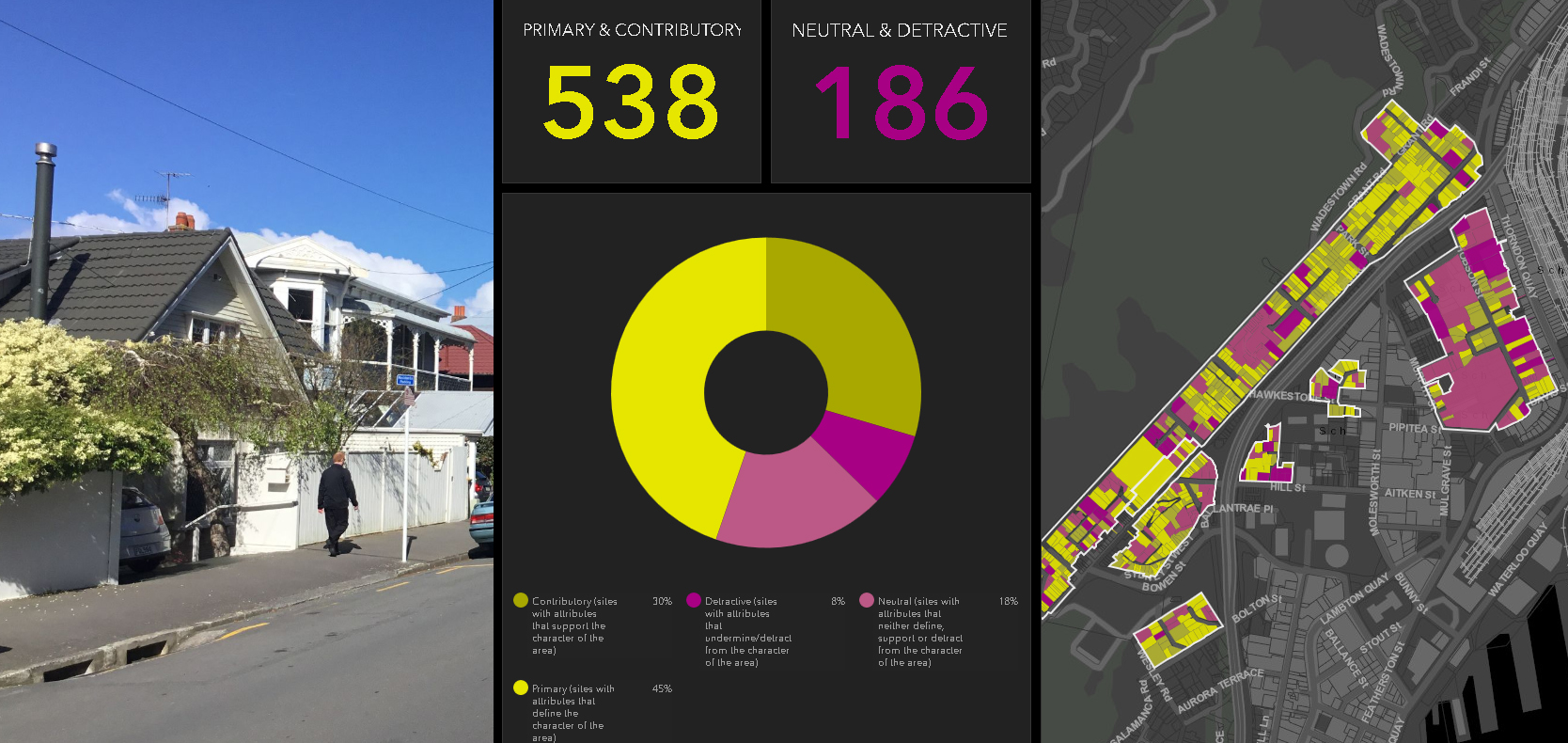
Character Reviews
Watch this video on how digital technology was used to capture, analyse and publish the recent WCC Pre-1930 Character Area Review.
Note: This video clip also contains audio
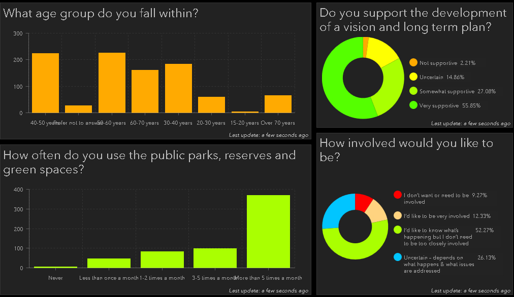
Consultation Surveys
Take a look at how we use Operation Dashboards to create online survey for public consultation and then dynamically display the results.

Rules-based Planning
Watch this video on using "Rules-based" software for modelling and testing of urban planning scenarios.
Note: This video clip also contains audio
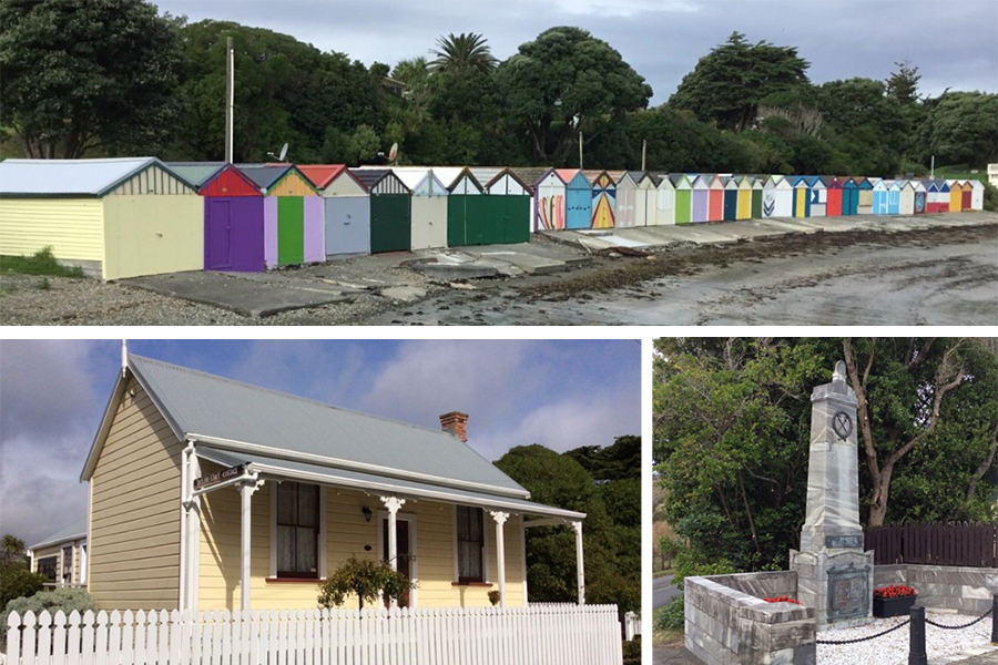
Heritage Studies
Using GIS to compile and display inventories of historic heritage buildings that can be displayed via council websites.
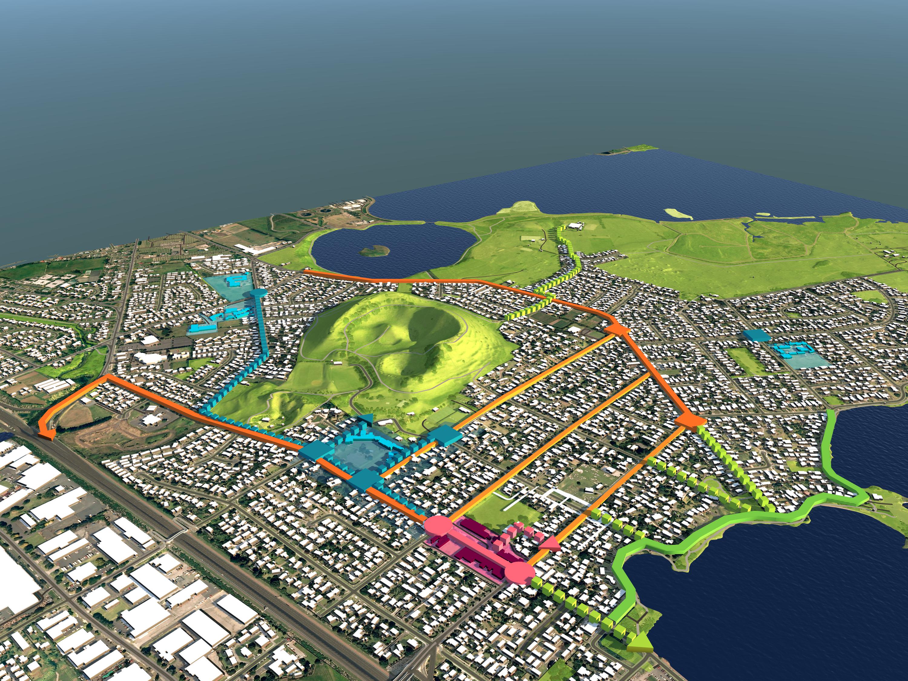
Interactive Models
Use cloud-based visualisation tools to quickly display GIS and 3D data in an interactive model where you are the pilot.
River Management
GIS web apps can be used to map key factors influencing flood management and control.
Virtual Reality
Heritage Sites
This 360o virtual model recreates a Military Training Camp that housed over 5,000 soldiers during WWI. The model can be accessed via a QR code on an interpretation panel to be installed on site.
Infrastructure
Portable VR Headsets and smartphone technology are used with these interactive scenes.
Click on the targets to jump to a new location, and on the BEFORE/AFTER key to see the changes.
Town Centres
This interactive tool was used during public consultation. The imagery was accessed via a portable VR Headset linked to a mobile phone.
Click on the targets to jump to a new location, and on the BEFORE/AFTER key to see the changes.
BIM and Landscape Design
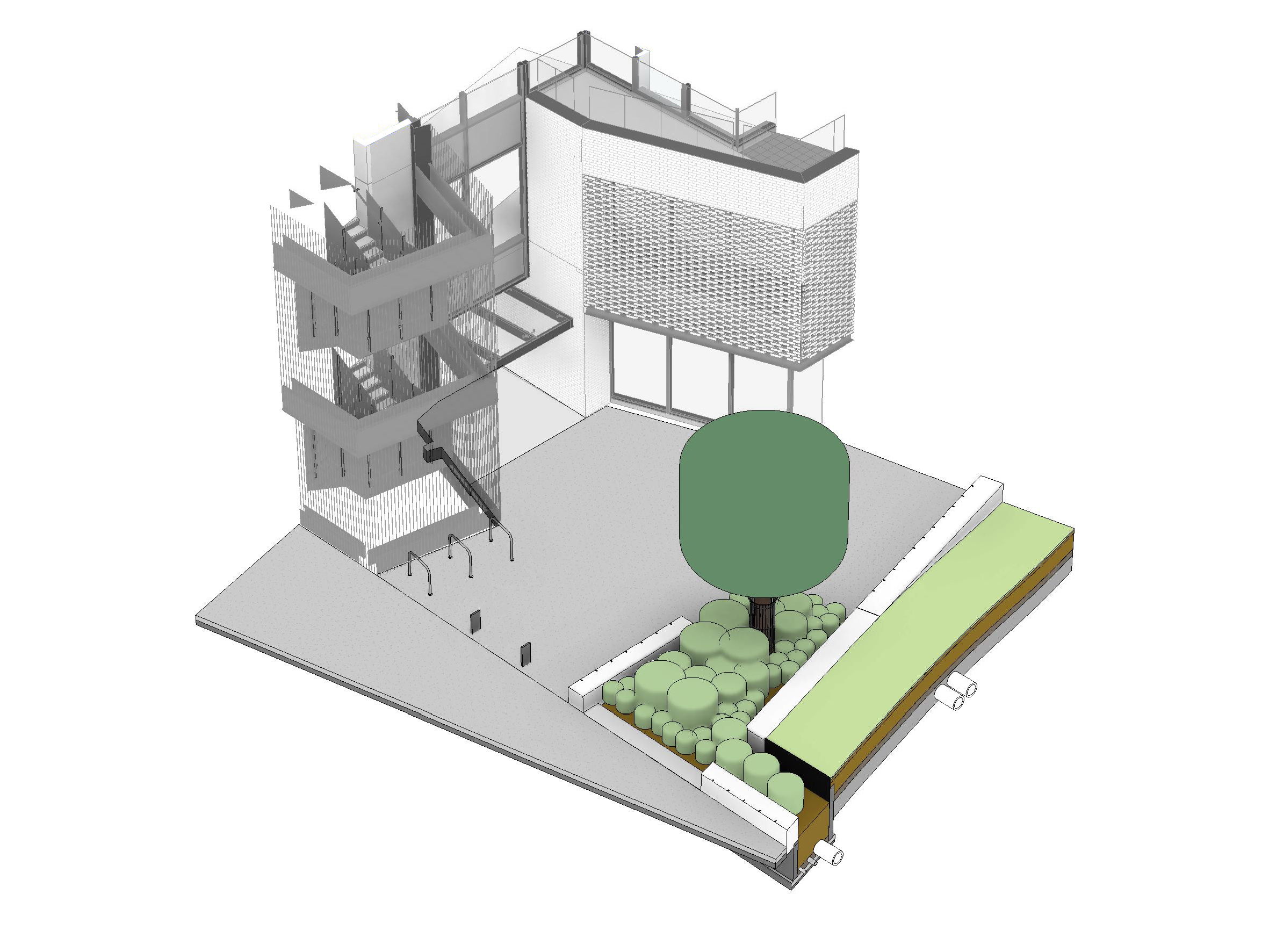
Collaborating with Consultants and Clients
Watch the steps from 2D plan through to 3D modelling - this demonstrates how we use the power of BIM software to integrate landscape design with architectural design.
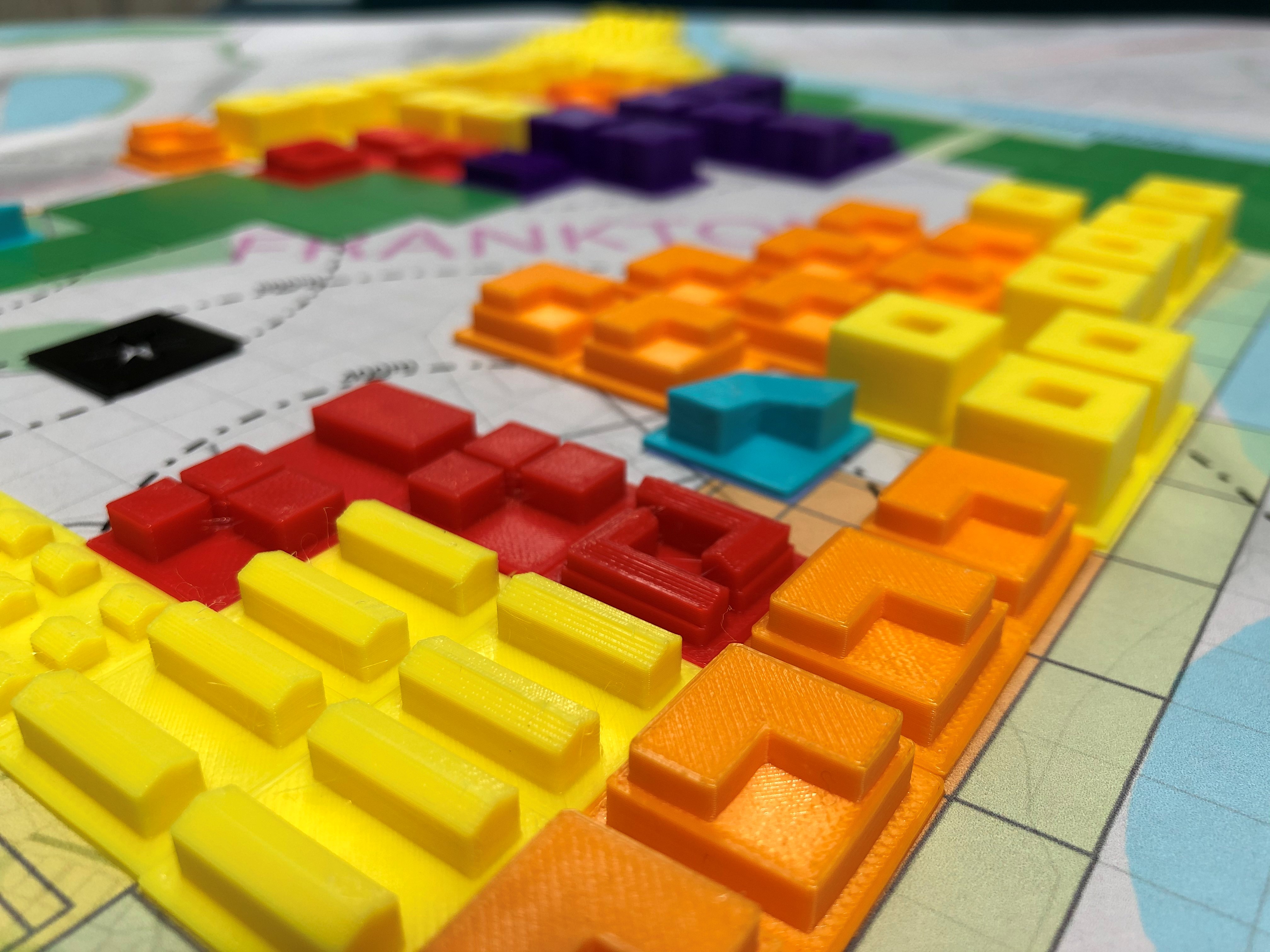
3D Printing
Our 3D Printing capability allows us to build physical, scaled models throughout the design process.