Visual Simulations (Urban)
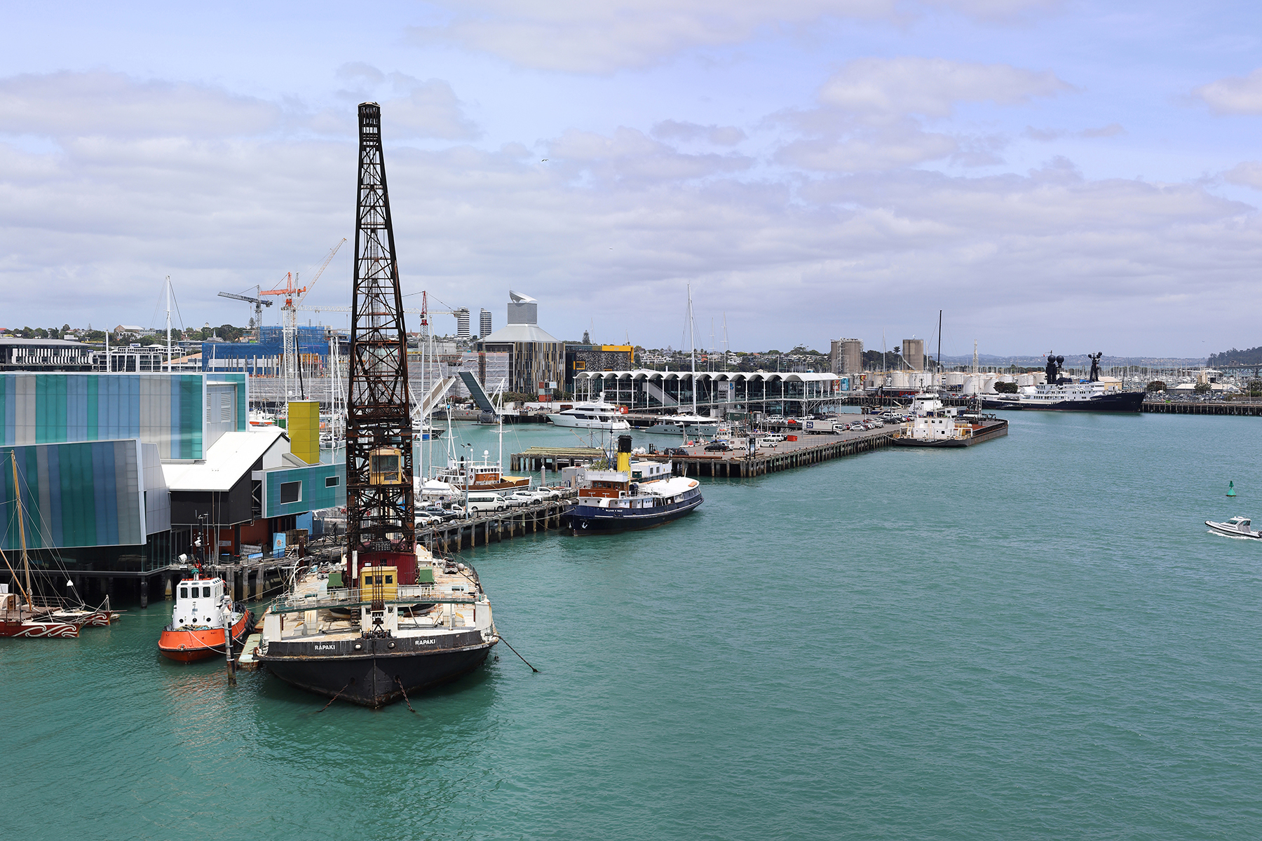
Waterfront
Boffa Miskell worked with other consultants on this waterfront redevelopment. A visual assessment - including simulations - were part of the application document.
Permission: Panuku Development Auckland
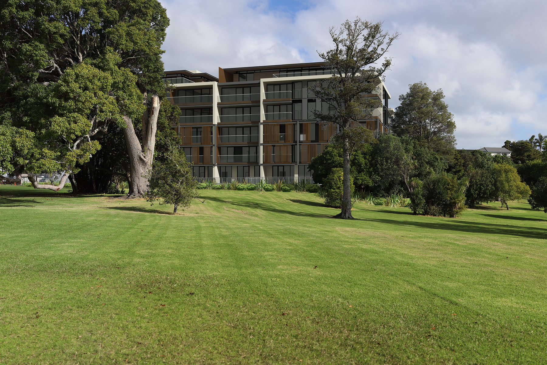
Urban
An example of how 3D architectural models are integrated with landscape design in an urban environment.
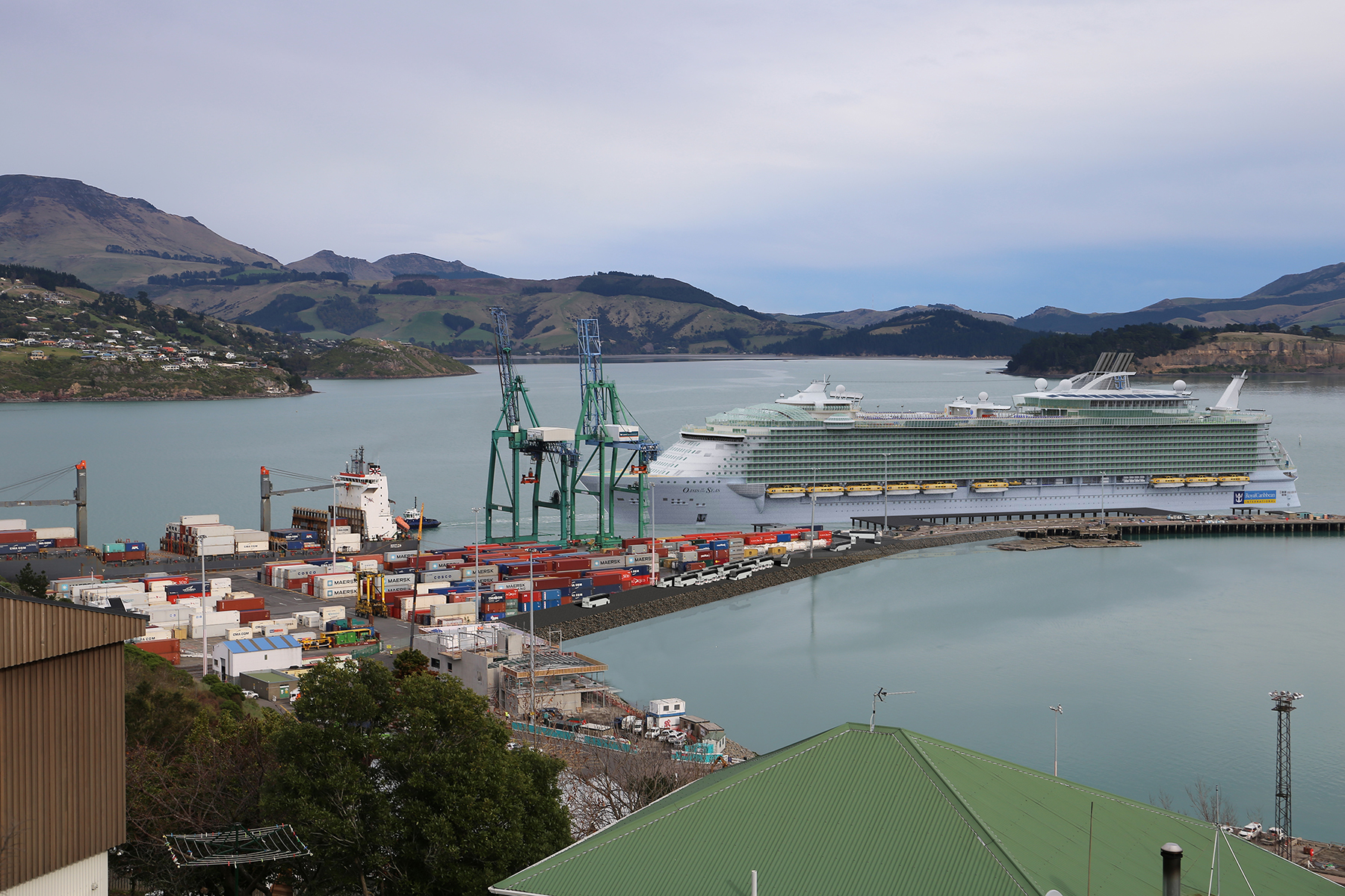
Infrastructure
Simulations were supplied to the client to assist in assessing the visual effects of a proposed reconfiguration of wharf facilities.
Permission: Lyttleton Port Company
Visual Simulations (Rural)
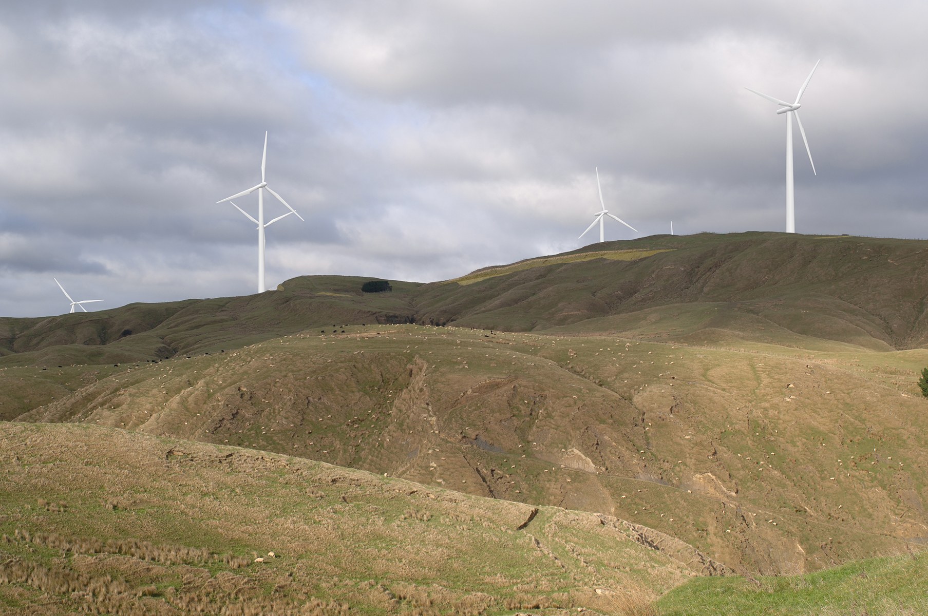
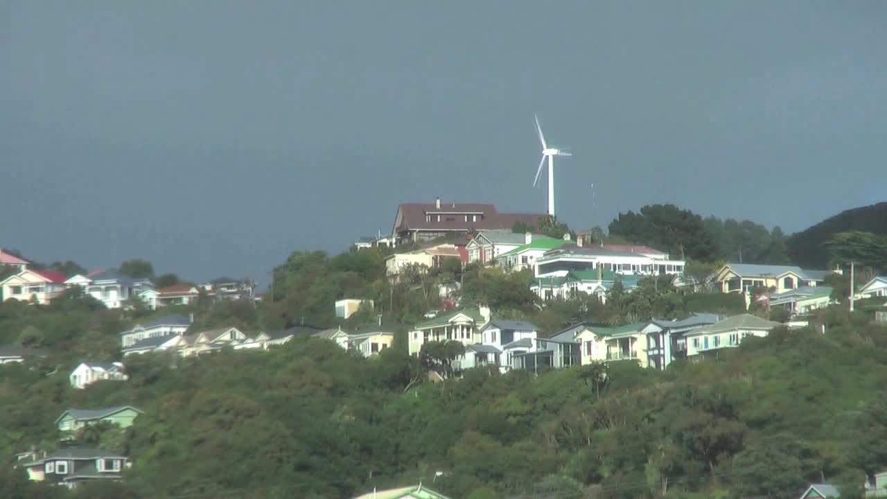
Energy
Simulations can be a valuable tool in assessing the visual effects of infrastructure projects in rural areas - in this case, for comparing the relative size and location of turbines.
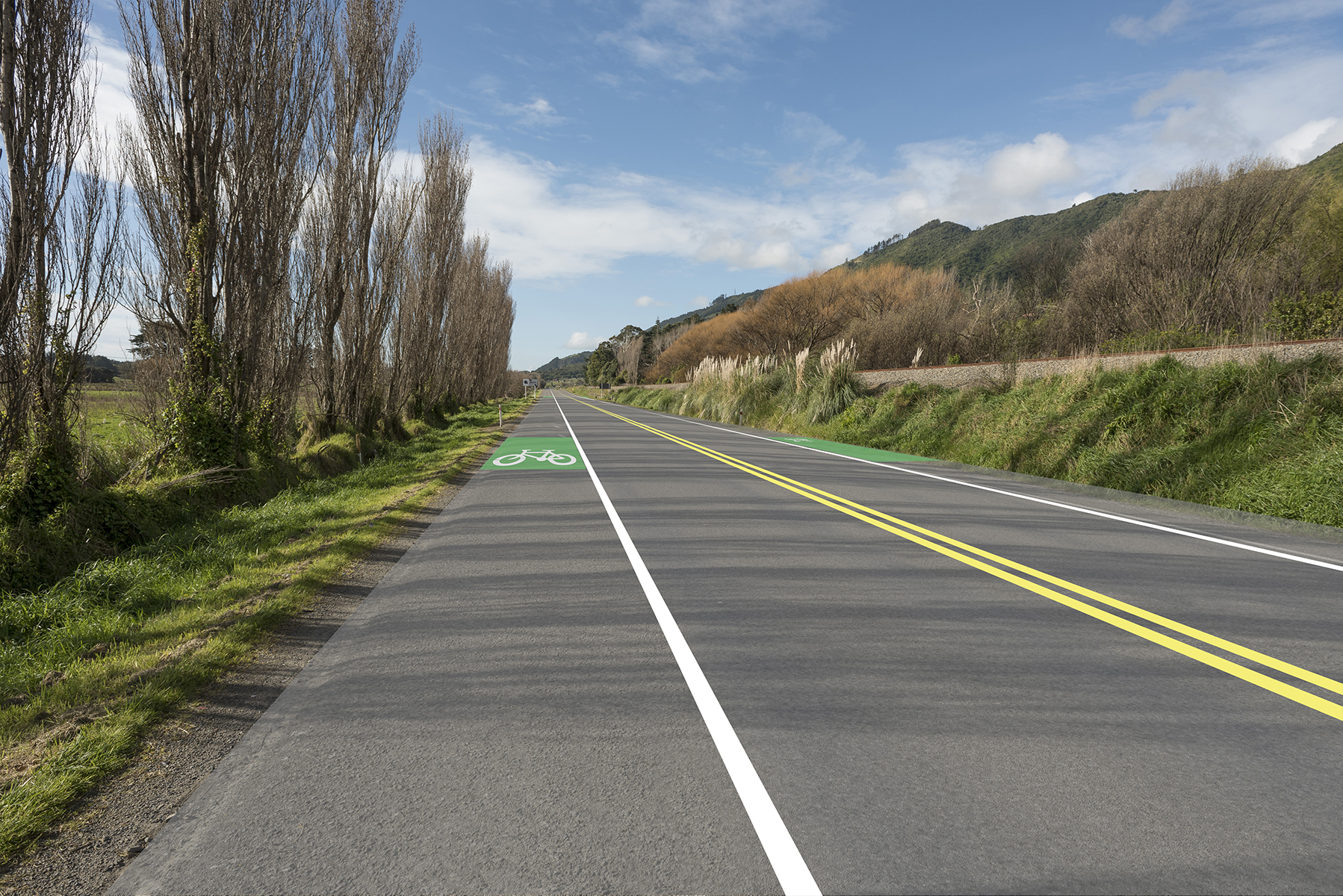
Transport
Assessing how cycleways could be incorporated into an existing road corridor.
Permission: Beca (NZTA)

GIS Analysis

Constraints
The suitability of a site for development relies on careful consideration of constraints including geological, ecological, visual and social ....we use our GIS suite of tools to analyse and present these.

Viewshed
The visual catchment of a proposed development is important in assessing the potential effects to the public. Watch this video to see how we use technology to assess this.
Note: This video contains audio

Shadows (Solar Studies)
Shadow Analysis can be presented as an animation or as a set of images - in either plan or 3D - for any location and on any day of the year.

Network Analysis
Network analysis tools can provide a better understanding of how pedestrian, cycling and vehicle behaviours might change. This example shows the walking times to the nearest existing bus stop of a proposed subdivision expansion.

Multispectral Analysis
Using near-infrared imagery from a dedicated UAV camera, we can perform multispectral (NDVI) analysis, allowing for more accurate assessment of the effectiveness of aerial spraying and of overall plant health.

Viewshaft Analysis
Looking for a sharp way to present your analysis and mapping? Our trained cartographers have an eye for presenting geospatial data in clear, concise and innovative ways.
Credit: Tupuna Maunga o Tāmaki Makaurau Authority
Visualisations
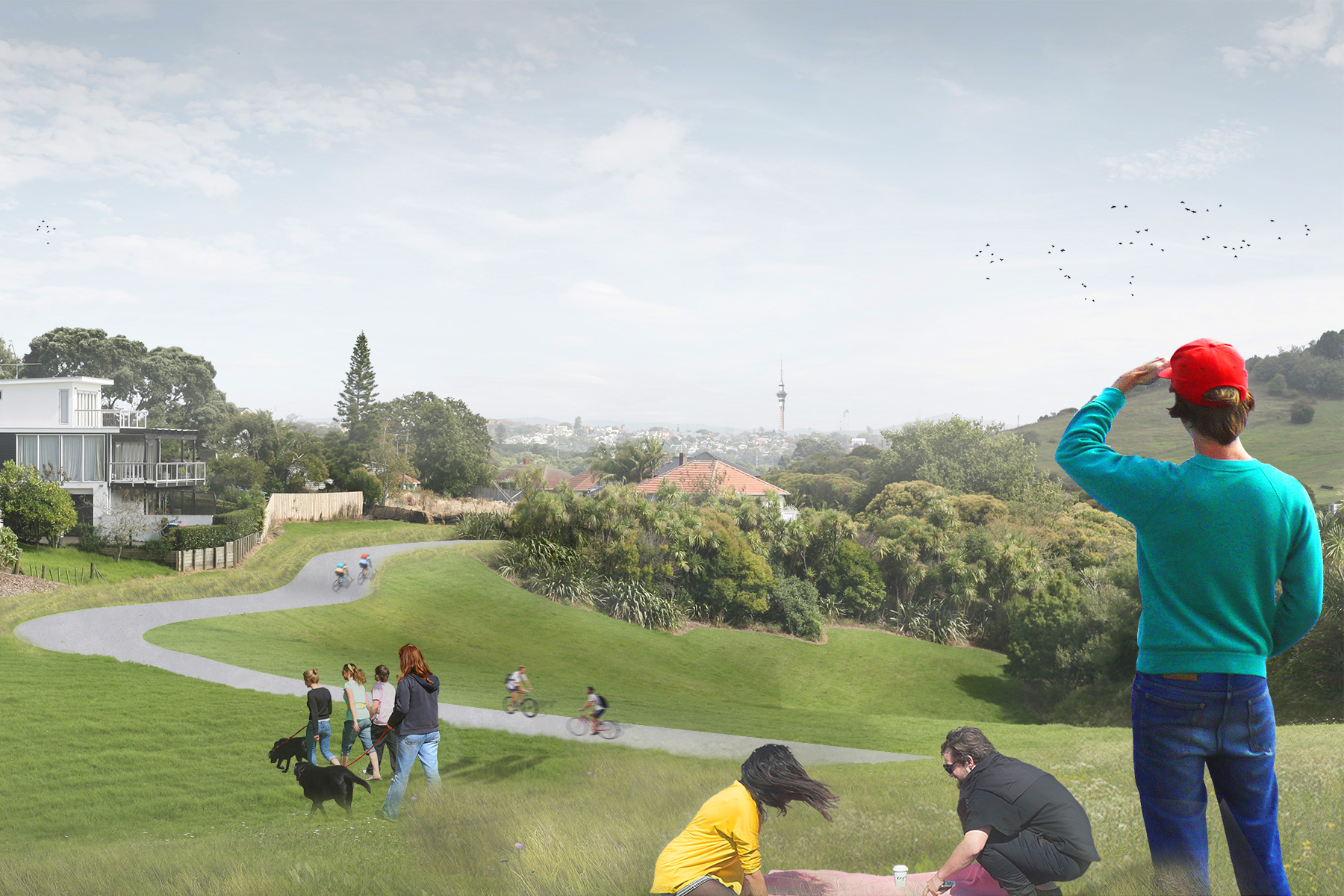

Urban
A set of visualisations based on drone photography can help communicate your vision.
Permission: Waimakiriri District Council

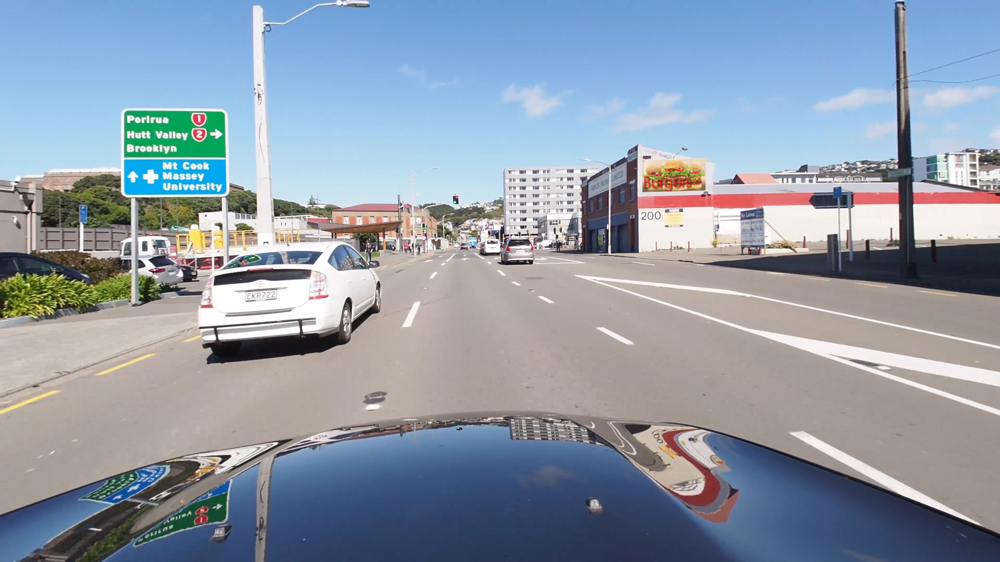
Transport
Enhancement of aerial imagery can be used to assist in planning processes.
Permission: Beca (NZTA)

Infrastructure
Boffa Miskell's multidisciplinary teams collaborated with their client on the redevelopment of the Te Ana Marina in Lyttleton Harbour ...this is one of the visuals produced for consultation.
Permission: Lyttleton Port Company

Night Visualisations
Utilising lighting specifications provided by lighting engineers, we are able to provide representations of infrastructure and streetscapes as they would appear at night.

Section Models
Section models are a great way to communicate how the various components of a streetscape will work together.
Animations

Construction Sequencing
Creating simple animations to help demonstrate construction sequences. In this example, the sequence of replacing a set of 2 lane bridges with larger 3 lane bridges is demonstrated.

Time of Day
This generic animation demonstrates how changes in lighting conditions, distance and aspect can vastly alter visual effects.

Climate Change
This animation emulates how the lake behind a disused quarry site would fill. Similar techniques can be used for climate change aand flood modelling.

Design Elements
Using animated elements superimposed over photography to convey elements of a landscape design.

Landscape Integration
Working with engineers and architects, this animation became a valuable tool in creating the best design outcome.

Fly Throughs
Boffa Miskell regularly works on redevelopment of town centres. This animation was used as part of the consultation process.
Permission: Tararua Alliance
Video
Shadows Timelapse
Although computer modelling is extremely powerful, sometimes the best way to record how shadows behave is through simple observation and the use of timelapse photography.
Dynamic Elements
Dynamic elements such as digital signboards don't lend themselves to the static visual simulations. We have developed techniques to superimpose such elements on to video, such as this example.
Weather Timelapse
This footage dramatically demonstrates how not only can weather and lighting conditions can change over a short period in New Zealand, but also how painted surfaces respond by significant changes in hue.